The story
Arlington had three lives, each tied to a road or a rail. It began in 1867 when the St. Louis–San Francisco Railway — the Frisco — reached the mouth of the Little Piney River in the Missouri Ozarks, and a Virginian named Thomas Harrison platted a town on his father's land and named it for Arlington, Virginia. For decades it was a pleasant river-and-railroad resort, drawing visitors into the hills.
Its second life came with Route 66, which ran through in 1926 and brought the Stony Dell Resort — a spring-fed swimming pool, cabins, a restaurant, and a filling station that did a brisk trade with travelers and soldiers from nearby Fort Leonard Wood. But the same highway that made Arlington eventually unmade it. As Route 66 was straightened and widened in the 1950s it bypassed the town, and when Interstate 44 came through in 1966 it severed Arlington from the highway entirely and demolished the old bridge. The post office had already closed in 1958.
What is left sits marooned between the interstate, the railroad, and the river: the ruins of Stony Dell, fragments of the old road, and a few structures slowly being reclaimed.
What remains today
Ruins of the Stony Dell Resort, including its pool, sections of old Route 66 roadbed, and scattered building remains between the Frisco line and the Little Piney.
Society Pro
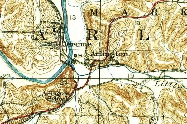
Arlington on the old USGS survey, and what the record holds around it
Within five miles the record maps 2 mine shafts, adits and prospect pits, 10 named mineral sites, 6 lost places and 17 cemeteries. Pro puts them on the map with the 1879–1919 survey underneath and a swipe to today.
From the archives

Source: Library of Congress digital collections.
Questions from the field
- What was Stony Dell in Arlington, Missouri?
- A popular Route 66 resort with a spring-fed pool, cabins, and a restaurant, busy with travelers and Fort Leonard Wood soldiers until the highway was rerouted. Its ruins are the main thing left of Arlington.
From the field
The most valuable part of this record is the part only visitors can write.
Stamp your passport
Check in at Arlington — GPS-verified visits earn an inked stamp.
File a field report
Road conditions, what's still standing, what's gone — your report joins the record.
Add photographs
Credited, dated, and preserved as part of Arlington's permanent record.
No field reports yet — sign in to file the first.
Primary sources for this record
- — USGS GNIS feature 748611
- — Wikipedia — Arlington, Missouri
- — Route 66 corridor histories