Membership
The Ghost Town Society
Some people collect stamps. Members of the Society collect places that no longer exist.
Society Member
ten dollars a year
- ✕The Passport. Check in at any town and it stamps your passport — inked if you were verifiably there, penciled if you logged it from home. State seals as you complete states.
- ✕Field badges. Mining Belt, Rail Rider, Population Zero, and rare stamps for the hard-to-reach sites.
- ✕Your photographs in the record. Credited, dated, and part of the town's page.
- ✕An ad-free atlas. The whole site, clean. Just the records and the map.
Society Pro
forty dollars a year
Everything in Member, plus the field layers
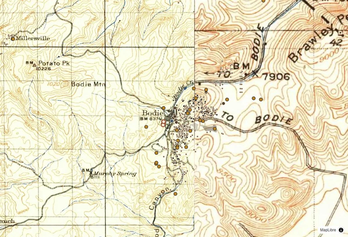
- ✕Historic USGS topo maps from 1879 to 1919 laid over today's ground, with a swipe between then and now — and a list of every USGS edition of any spot you click.
- ✕Today's USGS topo, aerial imagery and LiDAR relief, where old foundations and roadbeds show.
- ✕Lost places: 60,180 schools, 39,608 post offices, 8,934 churches and 22,570 named sites the maps no longer show.
- ✕When a place was alive: open and close years for 112,521 post offices, and a year filter for the whole map.
- ✕725,690 mine features — shafts, adits and prospect pits traced from USGS topo maps — and 304,328 mineral sites.
- ✕10 National Historic Trails, 957 battlefields and every cemetery in the federal record, the last two marked no detecting.
- ✕Land status on every map — BLM, Forest Service, parks, state and private.
- ✕A private field log. Pins and notes only you can see.
Before you swing a detector
- National parks ban metal detectors outright. On other federal land, anything archaeological over 100 years old is protected by law, and BLM allows only modern coins — no historic coins, bottles or townsite relics.
- Forest Service land allows casual detecting only away from historic sites. State land sets its own rules; private land needs the owner's permission, every time.
- Cemeteries and battlefields are marked on every Pro map as no-detecting ground. Take photographs, leave nails.
Cancel or switch plans anytime — switching is prorated. Prefer to browse free? The whole atlas stays open — start with the map.
Free accounts keep comments, check-ins, and basic stamps. Members who joined before Pro launched keep the land-status layer. Payments by Stripe.