The story
Lost Cove earned its name. The community sat in a steep hollow above the Nolichucky River on the Tennessee line, first settled around the Civil War by Morgan Bailey and a handful of families who lived on logging, farming, railroading, and — by most accounts — moonshine.
For a while the timber and the Clinchfield railroad kept it alive; the line was the town's only real link to the outside, since no road ever reached the cove. When the surrounding forest was logged out, the railroad stopped servicing Lost Cove, and the residents petitioned the state to build them a road. The legislature refused. Without the trains and without a road, families drifted away one by one until the last left in 1957.
The cove is now part of the Pisgah National Forest, and its collapsing log cabins and lone chimney are reached the same way people always reached it — on foot. The usual route is a steep hike of several miles from Unaka Springs, Tennessee, up along the active Clinchfield tracks and across the state line.
What remains today
Several decaying log cabins, a standing chimney, and a small cemetery in the forest above the Nolichucky.
Society Pro
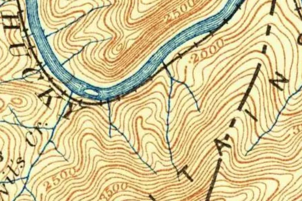
Lost Cove on the old USGS survey, and what the record holds around it
Within five miles the record maps 0 mine shafts, adits and prospect pits, 13 named mineral sites, 4 lost places and 1 cemeteries. Pro puts them on the map with the 1879–1919 survey underneath and a swipe to today.
From the archives
Lost Cove turns up on 92,625 digitized newspaper pages from North Carolina — read them free in the Library of Congress's Chronicling America collection.
Source: Library of Congress digital collections.
Questions from the field
- Why was Lost Cove abandoned?
- After the surrounding timber was logged out, the railroad stopped serving the isolated hollow. Residents asked the state for a road, were refused, and the community emptied by 1957.
- How do you get to Lost Cove, NC?
- Only on foot — there is no road. The common route is a demanding hike of about 3.5 miles from Unaka Springs, Tennessee, following the active Clinchfield railroad grade into North Carolina.
From the field
The most valuable part of this record is the part only visitors can write.
Stamp your passport
Check in at Lost Cove — GPS-verified visits earn an inked stamp.
File a field report
Road conditions, what's still standing, what's gone — your report joins the record.
Add photographs
Credited, dated, and preserved as part of Lost Cove's permanent record.
No field reports yet — sign in to file the first.
Primary sources for this record
- — USGS GNIS feature 1021291
- — U.S. Forest Service — Pisgah National Forest
- — Yancey County / Asheville Museum of History records