The story
Dana was one of four entire towns Massachusetts erased to give Boston its drinking water. In 1938 the state disincorporated Dana, Enfield, Greenwich, and Prescott and flooded the Swift River Valley to create the Quabbin Reservoir — still the largest body of water in the state and the main supply for metropolitan Boston. Around 2,500 people across the valley lost their homes.
Dana sat on higher ground than its neighbors, so much of the town was not submerged but simply razed. Residents had until the end of April 1938 to leave; at midnight the towns ceased to exist in law, and crews took down the buildings that hadn't already been moved. The valley filled slowly over the following years.
Because it stayed above water, Dana left the most walkable remnant of the lost towns: its town common. The state still mows the grass where the church, hotel, and stores once faced the green, and cellar holes ring the clearing at the end of a few miles' walk into the Quabbin reservation. It is the quietest kind of memorial — an intact town common with no town.
What remains today
The mowed Dana town common, ringed by cellar holes and old road traces, above the Quabbin's water line.
Society Pro
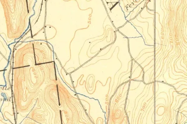
Dana on the old USGS survey, and what the record holds around it
Within five miles the record maps 1 mine shafts, adits and prospect pits, 1 named mineral sites, 5 lost places and 6 cemeteries. Pro puts them on the map with the 1879–1919 survey underneath and a swipe to today.
From the archives

Source: Library of Congress digital collections.
Questions from the field
- What happened to Dana, Massachusetts?
- It was disincorporated in 1938 and its people removed so the Swift River Valley could be flooded for the Quabbin Reservoir, Boston's water supply. Dana's higher ground was razed rather than submerged.
- Can you visit the Dana town common?
- Yes — it's a walk-in site in the Quabbin Reservation, reached on foot from Gate 40. The state maintains the common; the surrounding reservoir is protected watershed with strict rules.
From the field
The most valuable part of this record is the part only visitors can write.
Stamp your passport
Check in at Dana — GPS-verified visits earn an inked stamp.
File a field report
Road conditions, what's still standing, what's gone — your report joins the record.
Add photographs
Credited, dated, and preserved as part of Dana's permanent record.
No field reports yet — sign in to file the first.
Primary sources for this record
- — USGS GNIS feature 617471
- — Massachusetts Water Resources Authority — Quabbin Reservoir
- — Swift River Valley Historical Society