The story
Elgin was a cattle town on the raw edge of the frontier. Laid out in 1869 in the Big Caney valley of Chautauqua County, right on the Kansas–Indian Territory line, it became one of the largest cattle-shipping points in the state and a trading post for the neighboring Osage Nation. Herds driven up from Texas and the Southwest were held on the range around town and loaded onto rail cars for the eastern markets, and the country around Elgin picked up names to match its reputation — Shotgun Ridge, Robber's Cave, Outlaw's Corral, Hell's Bend — with the Dalton gang among those who passed through.
The cattle trade was Elgin's whole economy, and it did not survive the railroads reaching south. As lines pushed into Oklahoma in the early 1900s, the shipping pens moved closer to the herds, and Elgin's reason for being drained away. The post office finally closed in 1976.
Elgin is not quite gone — the 2020 census counted about sixty residents — but it is a shadow of the roaring railhead it once was, its old brick buildings standing mostly empty along quiet streets.
What remains today
Empty brick commercial buildings and a small living community strung along the Big Caney valley at the state line.
Society Pro
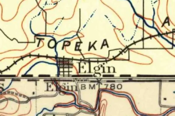
Elgin on the old USGS survey, and what the record holds around it
Within five miles the record maps 1 mine shafts, adits and prospect pits, 0 named mineral sites, 2 lost places and 7 cemeteries. Pro puts them on the map with the 1879–1919 survey underneath and a swipe to today.
Questions from the field
- Was Elgin, Kansas a cattle town?
- Yes — from about 1869 it was one of the largest cattle-shipping railheads in Kansas and an Osage trading point, until railroads reaching into Oklahoma moved the trade south in the early 1900s.
From the field
The most valuable part of this record is the part only visitors can write.
Stamp your passport
Check in at Elgin — GPS-verified visits earn an inked stamp.
File a field report
Road conditions, what's still standing, what's gone — your report joins the record.
Add photographs
Credited, dated, and preserved as part of Elgin's permanent record.
No field reports yet — sign in to file the first.
Primary sources for this record
- — USGS GNIS feature 469124
- — Wikipedia — Elgin, Kansas
- — Legends of Kansas — Elgin