The story
Monte Cristo sits deep in the Cascades along the South Fork Sauk River, and getting there is now a four-mile walk. In the 1890s it was a genuine boomtown: gold and silver strikes drew more than 200 claims and well over 1,000 people, with Rockefeller money behind a railroad built down to Everett to carry the ore.
The mountains fought back. Major floods in 1896 and 1897 tore out railroad tunnels and track, and though production hit records in 1897, the constant washouts and disappointing ore made the mines uneconomic. Operations stalled and then ceased by 1907. The road in flooded out for good in 1980, and the last building, a lodge, burned in 1983.
What remains is a scatter of ruins and foundations in a stunning mountain basin, cared for by the Monte Cristo Preservation Association. Repeated floods have taken chunks out of the old road, which is exactly why it was never reopened to cars — and why the hike in is most of the experience.
What remains today
Building foundations, mining ruins, a turntable pit, and scattered structures in the mountain basin, tended by the Monte Cristo Preservation Association.
Society Pro
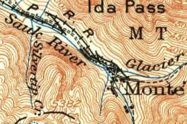
Monte Cristo on the old USGS survey, and what the record holds around it
Within five miles the record maps 11 mine shafts, adits and prospect pits, 334 named mineral sites, 0 lost places and 0 cemeteries. Pro puts them on the map with the 1879–1919 survey underneath and a swipe to today.
From the archives

Glacier basin, Monte Cristo Range, Cascade Mts., Wash.

Glacier falls, Monte Cristo Range, Cascade Mts., Wash.

Monte Cristo pass from summit of Penn Peak, Wash.

Monte Cristo
Monte Cristo turns up on 6,326 digitized newspaper pages from Washington — read them free in the Library of Congress's Chronicling America collection.
Source: Library of Congress digital collections.
Questions from the field
- How do you get to Monte Cristo ghost town?
- On foot — it is about a 4-mile walk each way from the Barlow Pass trailhead on the Mountain Loop Highway. The old road was closed after repeated floods, so there is no driving in.
From the field
The most valuable part of this record is the part only visitors can write.
Stamp your passport
Check in at Monte Cristo — GPS-verified visits earn an inked stamp.
File a field report
Road conditions, what's still standing, what's gone — your report joins the record.
Add photographs
Credited, dated, and preserved as part of Monte Cristo's permanent record.
No field reports yet — sign in to file the first.
Primary sources for this record
- — USGS GNIS feature 1523329
- — Washington Trails Association — Monte Cristo
- — Monte Cristo Preservation Association