The story
Loyston grew up in the early 1800s around a foundry built by John Loy, and over the decades became a small trading center for the farmers of the Clinch River valley — a post office, a few stores, a scatter of homes along State Highway 61.
It stood in the way of the Tennessee Valley Authority's very first project. Norris Dam, begun in the early 1930s, would flood the valley to generate power and control floods, and Loyston's residents were forced out by eminent domain. Before the water came, the TVA surveyed the community in detail and the photographer Lewis Hine documented its people; many families resettled just south as 'New Loyston.' The reservoir filled in 1936.
The valley now lies beneath the widest stretch of Norris Lake, a mile-wide expanse locals call the Loyston Sea. There is nothing to walk to — the town is simply underwater — but the shoreline of adjacent Big Ridge State Park, whose lodge and cabins were built by a Civilian Conservation Corps company once headquartered at Loyston, is the place to stand and look out over where it was.
What remains today
Nothing above water — the townsite lies under the 'Loyston Sea' of Norris Lake; the story is interpreted at neighboring Big Ridge State Park.
Society Pro
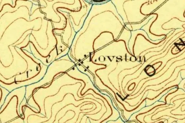
Loyston on the old USGS survey, and what the record holds around it
Within five miles the record maps 2 mine shafts, adits and prospect pits, 3 named mineral sites, 21 lost places and 39 cemeteries. Pro puts them on the map with the 1879–1919 survey underneath and a swipe to today.
From the archives
Loyston turns up on 51 digitized newspaper pages from Tennessee — read them free in the Library of Congress's Chronicling America collection.
Source: Library of Congress digital collections.
Questions from the field
- Why was Loyston flooded?
- It sat in the reservoir footprint of Norris Dam, the Tennessee Valley Authority's first dam. Residents were relocated by eminent domain and the valley was flooded when the lake filled in 1936.
- Can you see Loyston today?
- No — it lies under the widest part of Norris Lake, the mile-wide 'Loyston Sea.' The nearby Big Ridge State Park shoreline is the closest vantage.
From the field
The most valuable part of this record is the part only visitors can write.
Stamp your passport
Check in at Loyston — GPS-verified visits earn an inked stamp.
File a field report
Road conditions, what's still standing, what's gone — your report joins the record.
Add photographs
Credited, dated, and preserved as part of Loyston's permanent record.
No field reports yet — sign in to file the first.
Primary sources for this record
- — USGS GNIS feature 1311794
- — Tennessee Valley Authority — Norris Dam records
- — Tennessee State Parks — Big Ridge State Park